Platform:WinME,WinNT 3.x,WinNT 4.x,Windows2000,WinXP,Windows2003,Windows Vista Starter,Windows Vista Home Basic,Windows Vista Home Premium,Windows Vista Business,Windows Vista Enterprise,Windows Vista Ultimate
Earth Explorer is GPS Enabled digital map software with high-resolution satellite images and SRTM imagery of the world. It is a kind of educational scientific software of geography.
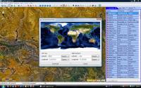
Earth Explorer is GPS Enabled digital map software with high-resolution satellite imagery, shaded relief topographic imagery and blending imagery of the two. It also include location information of 270 countries and regions, 50000+ cities, 15000+ islands and 50000+ earthquakes from 1973; And outline information of political boundaries, rivers, lakes, coastlines of the world and etc. All those map information was integrated together for providing a total 3D view of our beautiful planet earth. You can place your own placemarks and path routes to the map, show GPS tracks on the map and keep them with the maps if you connected with a GPS device. Beside these, it has many other interesting functions, you can regard it is a kind of educational scientific software of geography.
Key Features:
1. Support realtime satellite map GPS navigation on vehicle/ship/plane;
2. Support 30m-res satellite image(Landsat7) and 90m-res SRTM picture exploring in online/offline mode;
3. Include information of 270 countries and regions, 40000+ cities, 15000+ islands, 50000+ earthquakes from 1973 and vector layers includes political boundaries, coastlines, rivers, lakes, longitude-latitude grids;
4. User can add their own Placemarks, Paths, GPS Tracks to Earth Explorer;
5. User can define and add their own map style to Earth Explorer;
6. Support NEMA-0183 compatible GPS receiver;
7. Other functions like Measure and calculate distance and bearing between any two location, find by name, show day/night shadow effect, adjust Gamma, and etc.
8. Download maps to disk cache in background (Advanced license). Whats new in version 6.1: 1. Support self-define living map from local/network/web;2.Support altitude(from ground) in self-define location map;3. Support report gps location to your manager server periodically;4. Support popup html information when user click location item in the map window; 5. Background download bug fixed. Requirements: 256M RAM Operating system: WinME,WinNT 3.x,WinNT 4.x,Windows2000,WinXP,Windows2003,Windows Vista Starter,Windows Vista Home Basic,Windows Vista Home Premium,Windows Vista Business,Windows Vista Enterprise,Windows Vista Ultimate Release notes: Minor Update
Chemical database software for management of databases of any size, structure drawing, SDF import/export, duplicate removal, diversity analysis, chemical web server, combinatorial chemistry, prediction of LogP/LogC, and MASS/NMR/IR spectra management
Price: $50, Rating: 6, Downloads: 172 Download
ThreeDimSim is a powerful 3D mechanics simulation and rendering application. A 3D scene is defined by script using simple shapes and imported meshes from CAD files. Mechanics are simulated and rendered and can be analysed and exported.
Price: $89, Rating: 9, Downloads: 103 Download